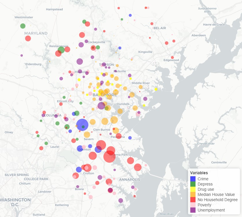
This research investigated how socially sensed data can be used to detect ZIP level characteristics that are associated with spatial and temporal patterns of Emergency Department patients with a chief complaint and/or diagnosis of overdose or drug-related health problems for four hospitals in Baltimore and Anne Arundel County, MD during 2016-2018. Dynamic characteristics were identified using socially-sensed data (i.e., geo-tagged Twitter data) at ZIP code level over varying temporal resolutions. Data about three place-based variables including comments and concerns about crime, drug use, and negative or depressed sentiments, were extracted from tweets, along with data from four socio-environmental variables from the American Community Survey were collected to explore socio-environmental characteristics during the same period.
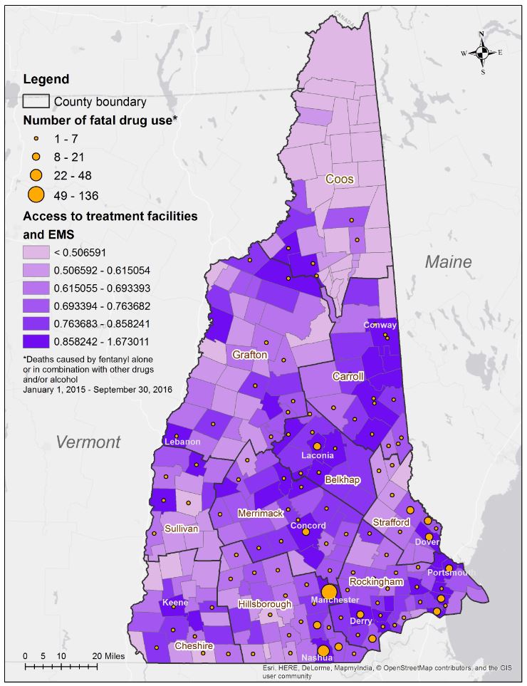
This research analyzed spatial accessibility to opioid use disorder treatment facilities and EMS services in New Hampshire. The study area was the focus of a National Drug Early Warning System (NDEWS) HotSpot study on unintentional overdoses involving fentanyl in 2015 and 2016. We designed a model to evaluate accessibility for opioid use disorder patients receiving services at treatment centers or from buprenorphrine waiverd physicians, as well as from Emergency Medical Services across New Hampshire. Geospatial determinants of spatial access included street network distances, driving times and distance decay relationships, while other key factors were services availability and population demand. The access results were compared with data on the towns of residence for individuals who died from unintentional overdoses involving fentnayl and found where the gaps are.
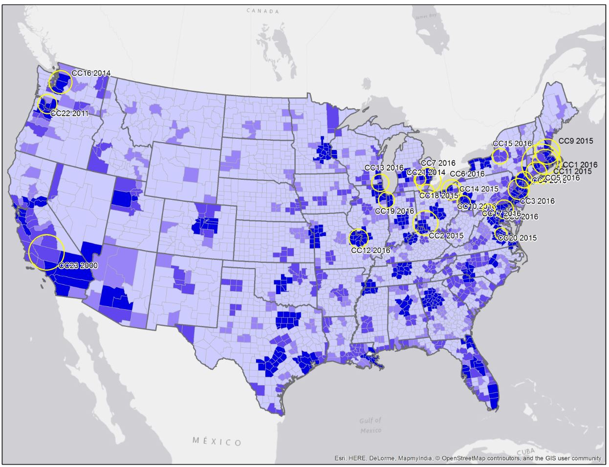
We investigate the geographic patterns of drug poisoning deaths involving heroin by county for the United States from 2000 to 2014. Rates based on raw counts of drug poisoning deaths involving heroin are estimated for different age groups and by gender. The geographic pattern has shifted from the west coast of the US in the year 2000, to New England, the Mid-Atlantic region, and the Great Lakes and central Ohio Valley by 2014. For this period, White males were found to be the most impacted population group overall, however, Blacks and Hispanic are suffering high impacts in counties where significant populations of these two groups reside. Our results show that while 35-54 year olds were the most highly impacted age group by county from 2000 to 2010, by 2014 the trend had changed with an increasing number of counties experiencing higher death rates for individuals 25-34 years. The percentage of counties across the US classified as large metro with deaths involving heroin is estimated to have decreased from approximately 73% in 2010 to just under 56% in 2014, with a shift to small-metro and non-metro counties.
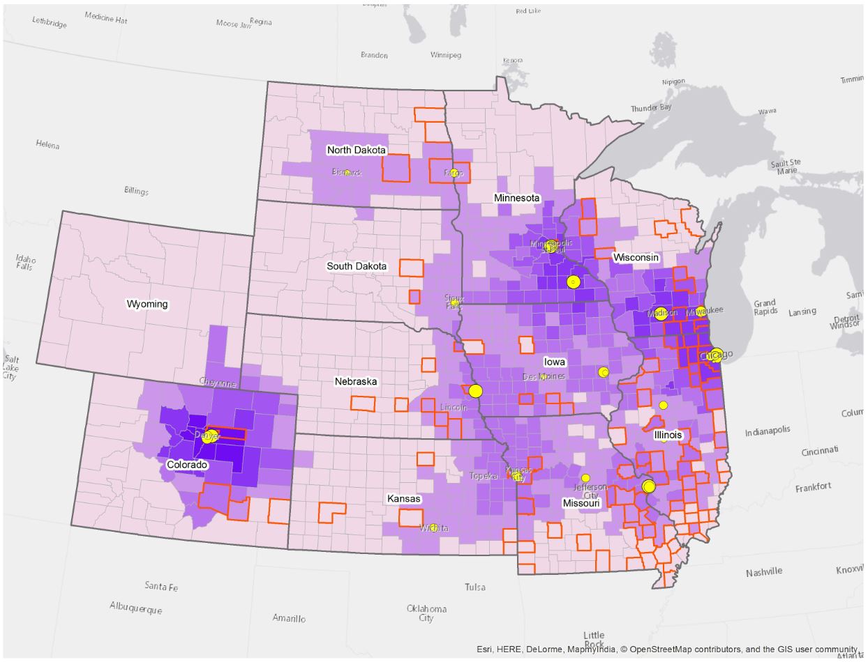
This research analyzes geographic patterns of ESRD incidence and kidney transplantation at county level in an area that covers 11 states in the Midwestern US from 2004 -2011. We investigate whether variations in ESRD incidence exist among white, black, and Native American population groups, and the degree to which disparities existed with respect to access to kidney transplantation, and with respect to rural and urban counties. Results show that while similar age-adjusted ESRD incidence rates hold for white and black population groups in urban counties, the kidney transplant rate is 73% lower among black patients than for whites in the study area. A lack of transplant centers in locations that correspond to strongly clustered age-adjusted ESRD incidence rates in southern Missouri and central South Dakota, contribute to lower spatial access indices in these counties. The results of the analyses capture varying patterns of ESRD incidence rates and kidney transplants in this Midwestern region and highlight spatial disparities for certain population groups.
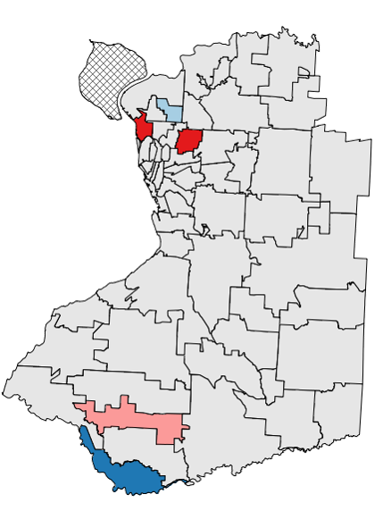
This research designed and populated a spatial and temporal data model for further analysis in terms of both community- and individual-level researches. Based on statistical methodologies for spatial and temporal analysis for prenatal exposure to drinking water, this research selected Erie County, New York, as study area at ZIP code level. Boil water advisories were chosen to demonstrate the data model and analyze the risk of being exposed to potential drinking water contamination. The results showed that although the spatial pattern for pregnancy records in each year is not strong, clusters still can be detected in pregnancies, as well as in risks of community exposure to contaminated drinking water. Furthermore, there is statistically significant change in pregnant women exposed to drinking water contamination in some communities (East Aurora and Gowanda). This research also simulated a sample of individual data to assess the benefits of the data model for higher resolution datasets.